Swiss Drone Maps
- Android +
- Version: 22.0
- 9.2Mb
Download (9.2Mb)
Updated to version 22.0!
2Gusoft
ch.abwesend.dronemaps
ch.abwesend.dronemaps
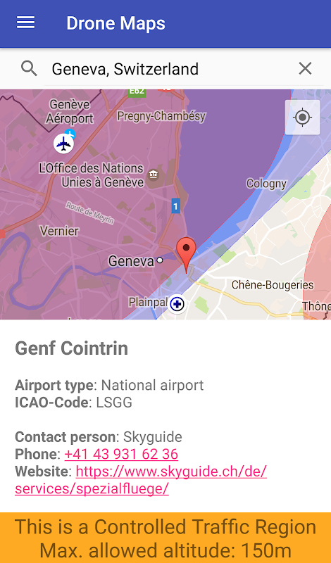
Pilots of drones and model airplanes can use Swiss Drone Maps to catch up on where they are allowed to fly. No-fly zones and controlled traffic regions are specifically coloured on the map and therefore easily visible. Airports and heliports are clearly visible thanks to intuitive markers on the map.
At higher zoom levels, the map shows relevant additional information such as hospital and mountain airfields. The selection of a site marker shows not only information about the area but also the phone number and website of the airport. This contact data allows for spontaneous and easy applications for special flight permits.
Disclaimer: We cannot guarantee 100% accuracy or correctness and decline any and all liability. This app is privately developed. It is based on publicly available data from both government- and non-government sources (see https://opendata.swiss/de/organization/bundesamt-fur-zivilluftfahrt-bazl for details). However, the developers have neither any legal authority nor are they affiliated in any way with the swiss government (apart from paying taxes to it).
Let us re-iterate that last statement: maybe even the our dear friends at Google will understand it, then. WE HAVE NO AFFILIATION WITH THE SWISS GOVERNMENT.
Questions and Answers
0 (0)
Screenshots


Additional Information:
- Updated
- Price$0
- Installs 37
- Last Updated 2025-06-29 02:28:17
Good speed and no viruses!
On our site you can easily download Swiss Drone Maps .apk! All without registration and send SMS!